CuriosiD: Why Isn’t Google’s Street View of Detroit Up-to-date?
Sascha Raiyn June 19, 2018A listener asks why we can’t see change in the city’s neighborhoods through Google-y eyes.

I’m looking to transition to Detroit to start a new business and it’s difficult to determine the quality and density of the neighborhoods on Google Maps Street View because they haven’t been updated since 2013 and sometimes even longer. I’d like to know why that is. Why haven’t the maps been updated? – Michael Harris
We sent Google Michael’s question. Google staff responded promptly with a straight forward and succinct answer – they asked us to keep off the record.
So, we had to google it.
How Google Does It
The satellite images in Google Maps come from the government-managed satellite program called Landsat. But Google also collects images from users. If you search Google for a local business, the Google Maps listing will include images from users who serve as Google Local Guides, offering reviews and tips on places in the city.
But Google Maps’ Street View images are a different story.

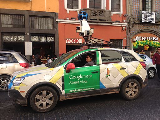
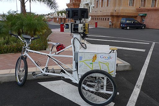
Google “Street View cars” actually drive the streets of the earth collecting images that Google will then stitch together to create the panoramic views you see in Google Maps. And it’s not just cars. There is a Street View “Trekker” – which is a backpack tricked out with cameras to collect images while someone walks. There’s a “trike” to ride through areas a car couldn’t navigate. There’s a snowmobile – for snowy places. And a cart for collecting images indoors.
Professional photographers and organizations such as tourism boards and government agencies can apply to Google to borrow a street view camera to document areas they think are interesting or important. Or you can buy one. Anyone can create and submit panoramic images for maps using Google’s Street View app.

So, one reason Street View images are not up-to-date is because collecting those images is pretty labor-intensive. And it involves a large, self-motivated volunteer corps with high-tech tools to help collect them.
So…How Do You Learn About Detroit?
For most areas Google Map images are between 1 and 3 years old. In Detroit that’s like dog years.
“In other neighborhoods like Oak Park or Ferndale or Southfield [Google Maps] are pretty reliable,” says Jason Hill, a broker for Historic Realty Detroit. ” but for Detroit there’s just no way.”
“Those maps have been created over three or four years ago and those streets look entirely different today — whether it be from demolition and or improvement with the landscape or new construction”
Hill says anyone who wants to learn about the neighborhoods in Detroit will have to find the people who know them best.
“If you have identified an address or a neighborhood in the city that you’re interested in,” Hill says. “Check with the local neighborhood associations.”
Hill says neighborhood associations — especially those for historic districts — will be well-informed about development and resources in the neighborhood and areas around it.

