
A History of Metro Detroit’s Extreme Tornadoes [TIMELINE]
As part of WDET’s series on the Palm Sunday outbreak of 1965, Pat Batcheller looks at more recent tornado extremes.
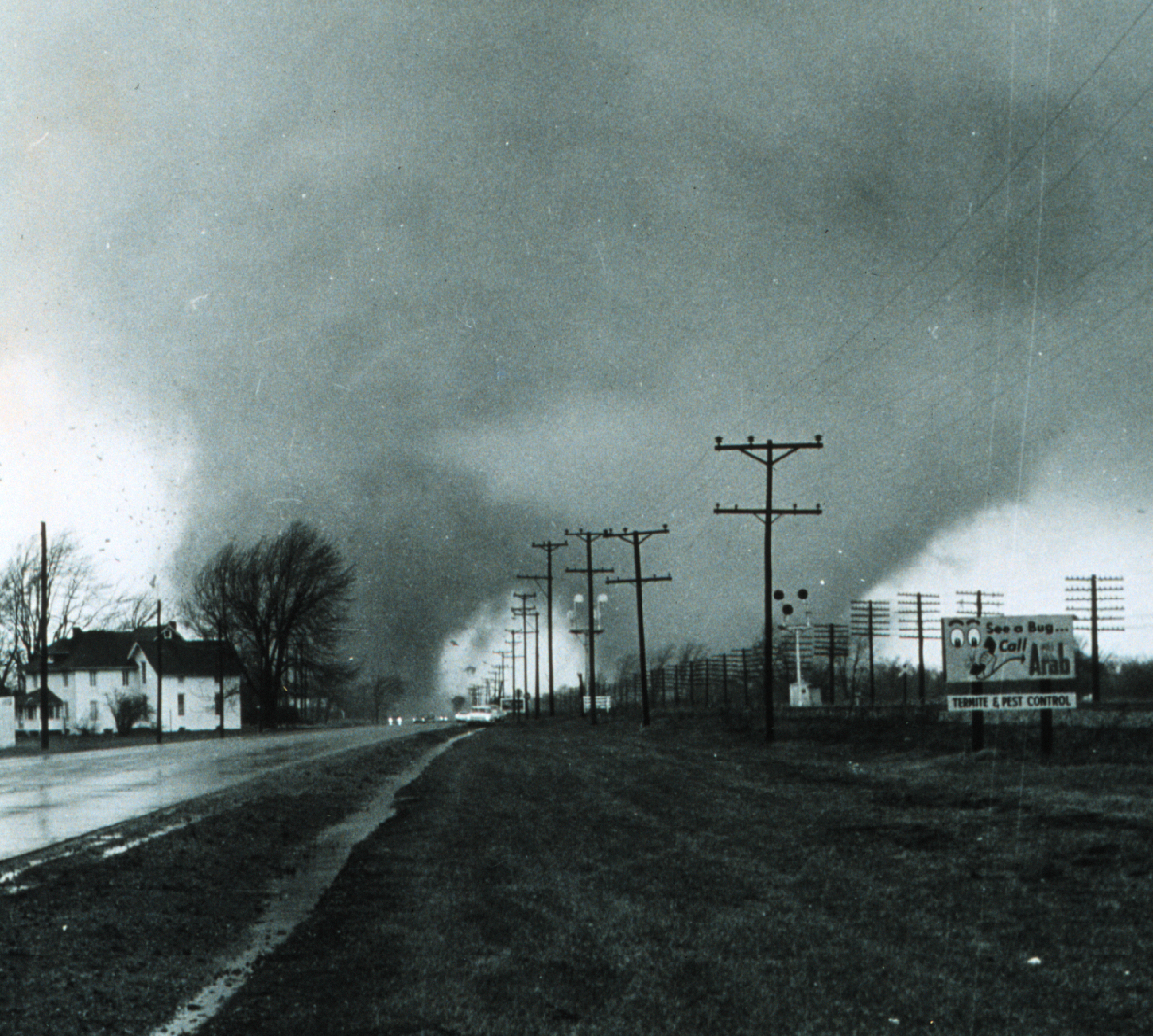
The Palm Sunday tornadoes that ripped across Monroe and Lenawee Counties in 1965 packed winds estimated at 200 miles an hour or more. Since then, only one other twister that powerful has struck Southeast Michigan: The West Bloomfield Tornado of 1976.
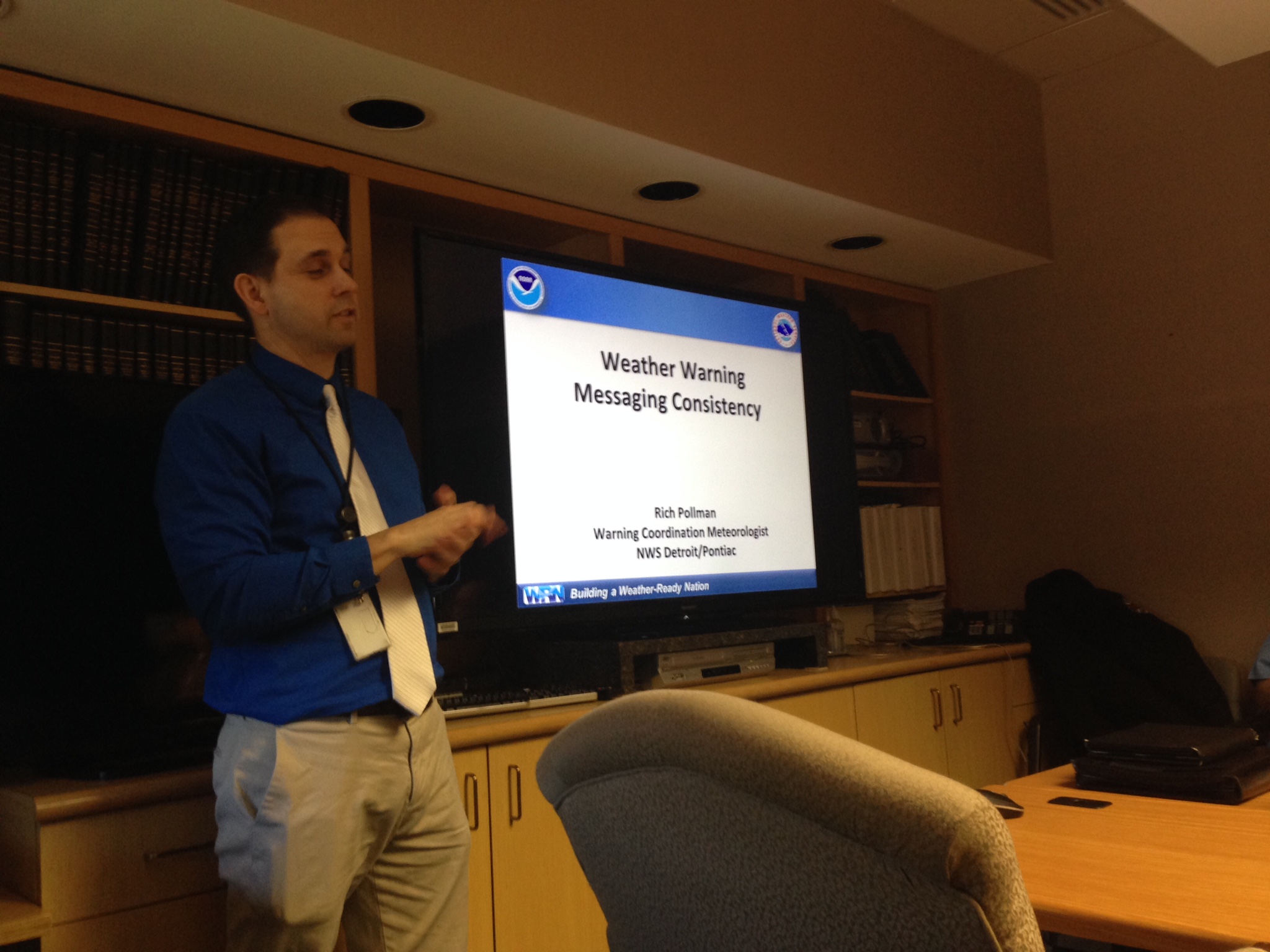
The date was March 20th—relatively early for tornadoes in Michigan. National Weather Service Meteorologist Rich Pollman says it was an unusually warm and humid Saturday night when a supercell thunderstorm dropped the twister in the heart of Oakland County.
“(It) touched down at 7:15, roughly between 13 and 14 Mile and out toward Halsted Road. The peak of the damage was centered around that Orchard Lake/Maple Road area, before it finally ended east of Middlebelt Road,” Pollman says.
The tornado killed one person, injured more than 50, and caused millions of dollars in property damage. Those who lived through it still have vivid memories of that night. Debbie Zager was in her kitchen at the time. In an interview with West Bloomfield Civic Center TV, she recalled the noise the storm made.
“I thought it was an airplane crashing in our back yard. The next thing I knew, the window imploded. And all the cabinets and the countertops went flying behind me,” Zager says.
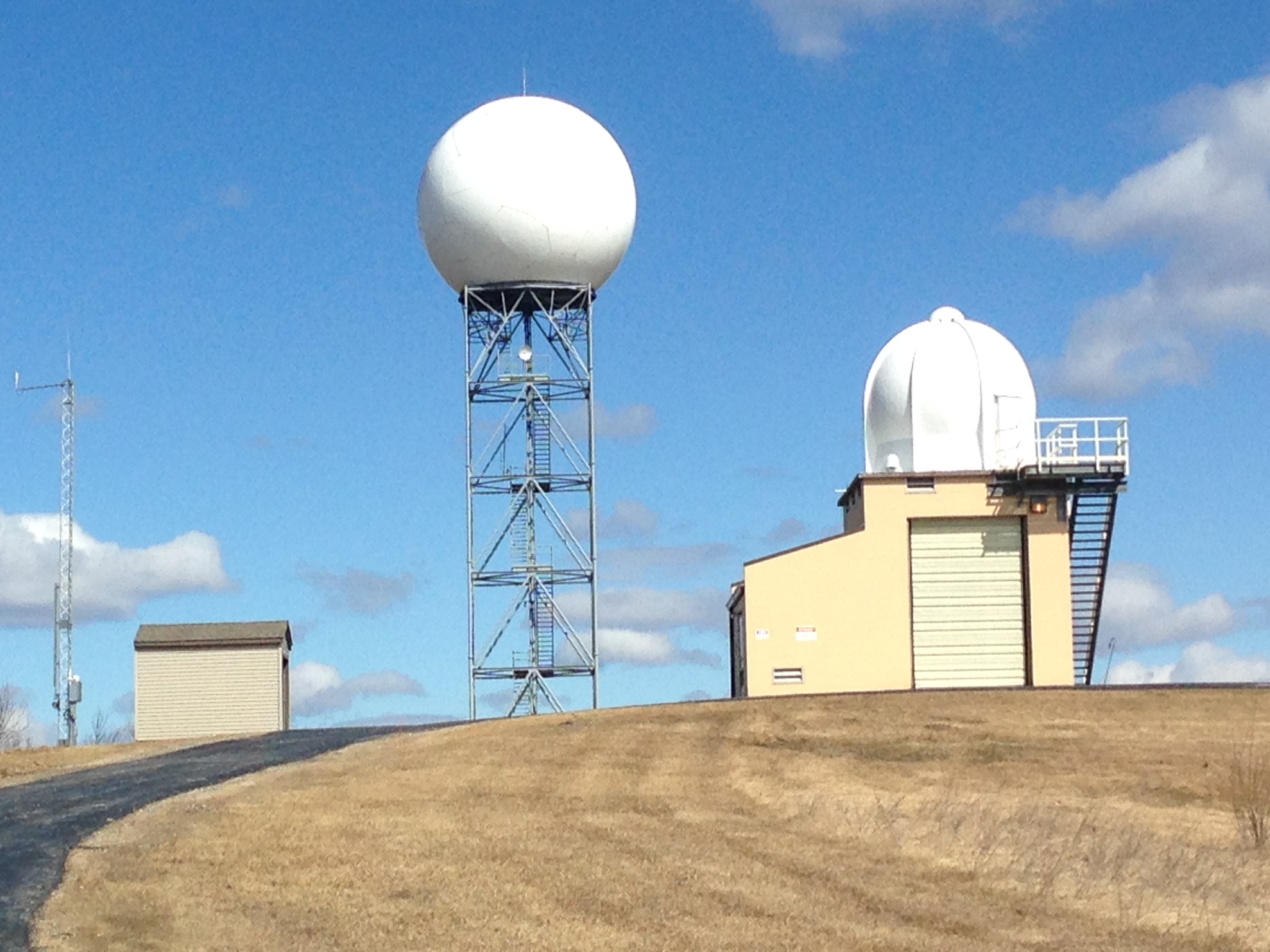
Forecasters had predicted the possibility of a tornado that night. But in 1976, they didn’t have the technology to detect a tornado and issue a warning with more than a couple of minutes for people to find shelter. Rich Pollman at the National Weather Service says the big difference between then and now is radar.
“We wouldn’t have had the Doppler radar where we could see inside the storm. We can see the motion and we can see that rotation. In today’s radar, we would have been able to provide 10 to 20 minutes worth of lead time before the tornado touched down,” Pollman says.
Besides better radar, better science has helped Pollman and other forecasters predict where and when violent tornadoes might form. They can also project an outbreak like the one that happened on July 2nd, 1997. It produced the most tornadoes Southeast Michigan has seen in one day: 13, including the last one to touch down in Detroit. That twister cut a five-mile path of destruction from Fenkell and Outer Drive through Highland Park and Hamtramck, causing $90 million in damage. Eric Bryant left his job in downtown Detroit to see the aftermath.
“It’s…it’s awesome, I mean it’s devastating. It’s the first time in 40 years I’ve seen anything like that to hit Detroit,” Bryant recalls.
The Detroit tornado dissipated near the General Motors factory in Hamtramck. But the thunderstorm that produced it moved into Grosse Pointe Farms, where 100 mile an hour winds tossed a gazebo full of people having a picnic into Lake St. Clair, killing five.
Since the Palm Sunday outbreak, tornadoes have killed only seven other people in Southeast Michigan. Better radar and earlier warnings have given people more time to take shelter, increasing their chance of survival. The National Weather Service also relies on a network of trained spotters who have a reporting tool they didn’t have until very recently—social media. When a tornado hit Dexter in 2012, a man at Hudson Mills Metropark videotaped it and put it on YouTube.
NOTE: This video contains some foul language.
Such instant technology is a far cry from the days when forecasters would have to wait for photographs to be developed. Rich Pollman at the National Weather Service says social media not only helps meteorologists confirm tornadoes faster than ever, it gives them another way to warn people sooner.
“We can re-tweet that out and let everybody else know and continue to spread the word that, yes, that tornado warning has a tornado associated with it, get to your shelter, and get to safety,” Pollman says.
Pollman says people can not only send weather information with their cell phones—they can receive it. The National Weather Service and other agencies now send texts alerting people of severe weather wherever they are, or are going to be. And, as always, Pollman says forecasters still depend heavily on traditional media—TV and radio stations — to prepare Southeast Michigan for the next tornado.